top of page


How Drone Photogrammetry and CGI Can Revolutionise Construction Marketing and Selling Off Plan.
In the world of property development and construction, the ability to effectively showcase a project can make all the difference....
ian7355
Jan 243 min read
6 views
0 comments


Paving the Way: How Ely Aerial Imaging Delivered Survey Level Precision with Lidar and RGB Imaging for a New Road Project
When a large construction company needed to map a 10-kilometer stretch of challenging terrain for a new road project, they turned to Ely...
ian7355
Jan 133 min read
7 views
0 comments


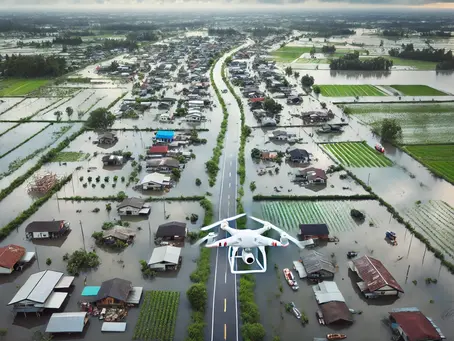
Mapping the Flood: How Drones Are Transforming Flood Assessment Surveys
Natural disasters like floods can strike with devastating force, leaving destruction in their wake and posing enormous challenges for...
ian7355
Jan 72 min read
7 views
0 comments

The Role of Drone Mapping in Creating Digital Twins for Urban Innovation
Cities today face unique challenges in their planning and development journey. Traffic management and energy usage optimisation present...
ian7355
Dec 12, 20244 min read
10 views
0 comments

Transforming Land Surveys: Ely Aerial Imaging Achieves Sub-20mm Accuracy for Major Development in the North of the UK
Project Overview A major new residential development in the North of England required a detailed topographical survey to assist with site...
ian7355
Dec 4, 20243 min read
19 views
0 comments

Real-Time Data Solutions for Construction Site Monitoring
In the bustling world of UK construction, staying ahead of the curve is not just an advantage—it's a necessity.
ian7355
Nov 13, 20242 min read
7 views

How Drone Mapping is Transforming Construction Quality Control: Real-Time Data, Better Results
In the construction industry, quality control is often seen as the backbone of project success. With high investments and tight...
ian7355
Nov 6, 20244 min read
9 views
0 comments

Maximizing Project Efficiency: The ROI of Drone Mapping in Cost-Effective Management
In the evolving landscape of project management, the integration of technology often serves as a cornerstone for improving efficiency and...
ian7355
Oct 31, 20246 min read
7 views
0 comments

The Financial and Efficiency Advantages of Drone Mapping, Surveying, and Photogrammetry
Traditional surveying methods, while reliable, often involve significant time and labour costs. In contrast, drone-based solutions offer...
ian7355
Oct 24, 20242 min read
3 views
0 comments

Enabling Safe BVLOS Unmanned Aircraft Operations in Atypical Air Environments: A New Policy by the CAA: A summary of CAP3036
The UK Civil Aviation Authority (CAA) has launched a policy to facilitate Beyond Visual Line of Sight (BVLOS) operations for Unmanned...
ian7355
Oct 16, 20242 min read
1 view
0 comments


How Ely Aerial Imaging Revolutionised Site Imaging for Deanta (UK) with Aerial Photography: A Case Study
Introduction Ely Aerial Imaging, a leader in aerial mapping, surveying, and photogrammetry, has partnered with Deanta UK to provide site...
ian7355
Oct 10, 20242 min read
10 views
0 comments


The Accuracy of Drone Surveys: A Comparison of RTK GPS and Ground Control Points
In the rapidly evolving field of surveying and mapping, drones—also known as unmanned aerial vehicles (UAVs)—have transformed the...
ian7355
Sep 30, 20243 min read
3 views

Unlocking the Future of Drone Operations: The UK CAA’s Strategy for BVLOS Flights
The UK Civil Aviation Authority (CAA) has laid out an ambitious strategy to make **Beyond Visual Line of Sight (BVLOS) drone operations...
ian7355
Sep 24, 20243 min read
0 views
0 comments

Using Drones for Building Inspections and Estate Management
In the building inspection and management sector, efficiency and safety are key. Traditional methods often involve time-consuming and...
ian7355
May 7, 20242 min read
7 views
0 comments


Maximizing Efficiency and Expertise: The Advantages of White Labelling Drone Surveying Operations with Ely Aerial Imaging
In an era where aerial data is increasingly crucial for decision-making across various industries, businesses are turning to drone...
ian7355
Apr 23, 20242 min read
5 views
0 comments


Using Drones to Optimize Vegetation Management on the Railway Network
The maintenance of vegetation along railway networks is crucial for ensuring safe and reliable operations. Overgrown vegetation poses...
ian7355
Apr 19, 20243 min read
23 views
0 comments

Drones in 3D Visualisation for the Construction, Surveying, and Civil Engineering Industries.
In today's construction and civil engineering landscape, the integration of cutting-edge technology has ushered in a new era of...
ian7355
Apr 18, 20243 min read
10 views
0 comments

Just how accurate are drone surveys?
Drones have now become a more established feature in the surveying workplace, however, the pivotal question lingers: How accurate are...
ian7355
Apr 15, 20242 min read
20 views
0 comments

The benefits of drones in the construction, surveying, and civil engineering sectors.
In recent years, the emergence of drone technology has brought about significant changes in various industries, with one of its most...
ian7355
Apr 9, 20243 min read
3 views
0 comments

Revitalising Historic Buildings through Geolocated Digital Twins and Drone Technology: A Case Study
Preserving the rich heritage of historic buildings while ensuring their structural integrity presents a complex challenge. Cambridge, a...
ian7355
Oct 18, 20232 min read
49 views
0 comments
bottom of page
